🗺️ Map (Mobile)
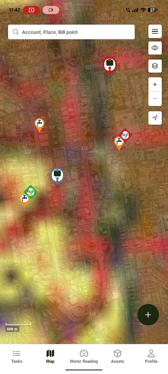
The mobile Map mirrors the web map — it's the same operational data, plotted for use in the field.
Markers
The map shows three types of markers:
| Marker | Tapping it shows |
|---|---|
| Billing Point | Billing point info, plus Connect / Disconnect actions |
| Meter | Meter info, and lets you add a Meter ID |
| Task | The task's details |
📷 Screenshot Placeholder
Image:
water-works-map-marker-popups.pngPurpose Show the info panel that opens for each marker type — billing point (Connect/Disconnect), meter (add Meter ID), and task.
Layers
A layers control lets you toggle what's shown on the map — useful for focusing on just billing points, just meters, or just tasks depending on the work at hand.
Search
Use the search bar to locate a billing point, customer, or address — the map moves to the matching location.
Offline Map Menu
The menu icon next to the search bar opens three options:
- Offline Map
- Manage Offline Areas
- Sync Queue
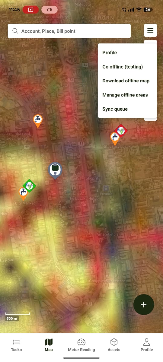
➜ See Offline Maps for the full download and sync flow.
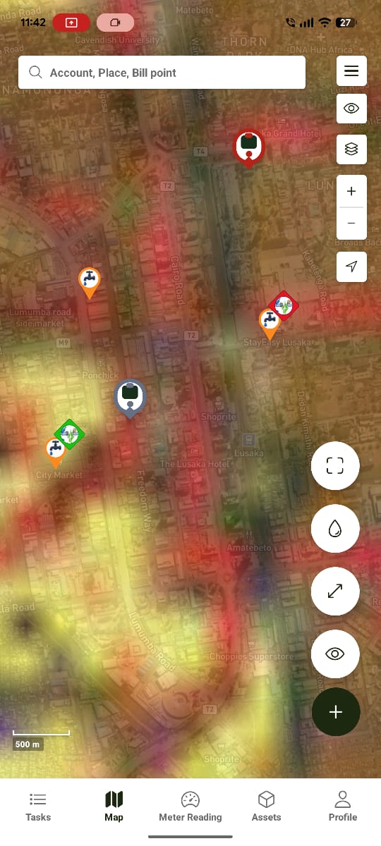
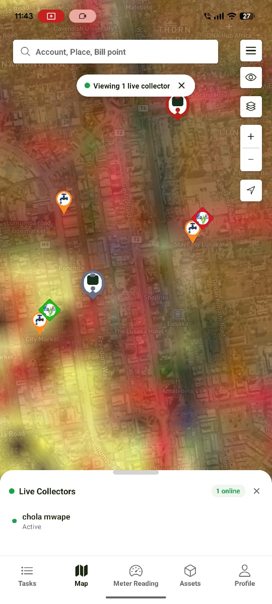
Quick Actions
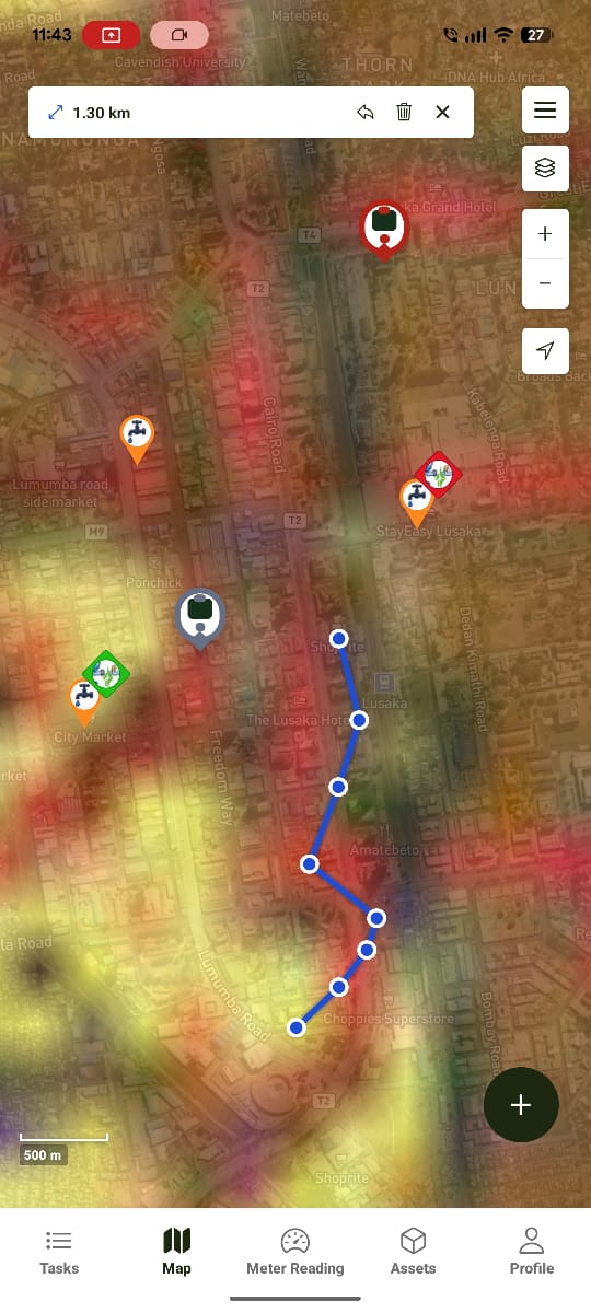
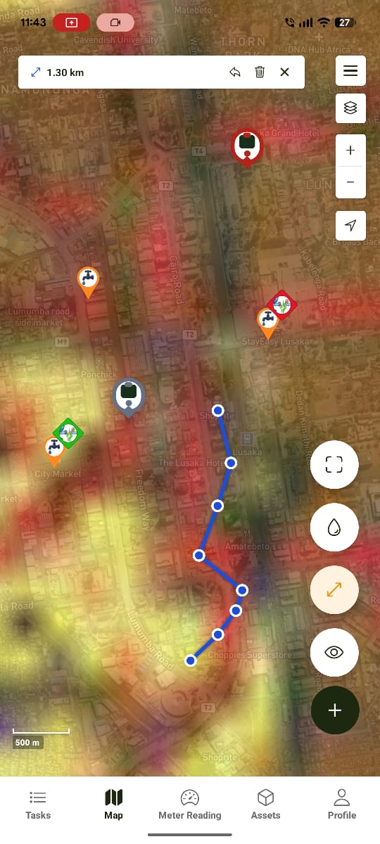
⚠️ Needs confirmation — there's a floating + button at the bottom of the map that expands into a small action menu. Screenshots below show Meter Reading, Measure Distance, and View Collectors icons, but the exact labels and behaviour weren't confirmed clearly during the walkthrough and shouldn't be treated as final until verified.
Offline Behaviour
The map keeps working offline once an area has been downloaded — markers are read from local storage and load instantly. See Offline Maps for the download flow.
Expected Behaviour
The map should:
- Plot billing points, meters, and tasks accurately.
- Open the correct info panel for each marker type.
- Respect the active layer selection.
- Keep working from local data while offline.
Related Pages
- Water Works Overview
- Tasks (Mobile)
- Assets (Mobile)
- Offline Maps
- Maps — the web equivalent of this module